Maps
Maps
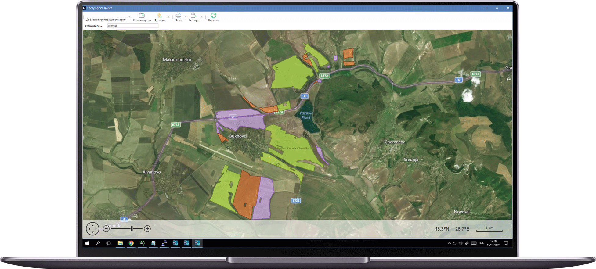
Trace productivity from a bird`s eye view
Entegra Maps is a specialized mapping solution a part from the entire software platform, which visualizes on a satellite imagery all fields in the farm with coloring and legend depending on various indicators and reports e.g. crop, profitability, yield, etc.
Fields
 Import of fields from SHP files and organizing by crop seasons. Ability to upload one by one or many objects at once. Option for group update of the sown crop.
Seasons

The system retains history of previous years: fields, area in hectares, crop, but at the same time it is updated every year after changes in the land bank. In this way, cost, yield and profit are monitored in real and current fields with benchamrking options versus previous years.
Visualization

Color visualization and grouping by various indicators with legend:
- • Crop
- • Field operations
- • Costs invested (low, average, high)
- • Yield (low, average, high)
- • Profitability
-
-
Tools

Otion for work with two monitors, as on the 1-st are projected the fields and the operations in tabular form (operational screen), and on the 2-nd the same information is displayed, but in map view. Ability to interactively select fields from the map and create a bulk plan or field activities.
Integrations

Integration with MyJohnDeere.com to automatically download the current field outlines for the current business year.
-


Get your FREE consultation
We want to show you the best ways to optimise your business processes.
See all software modules
We want to show you in details all the modules you can include in your software.